situs toto

https://internationalbookofrecords.com/

https://internationalbookofrecords.com/

https://internationalbookofrecords.com/

https://internationalbookofrecords.com/

https://internationalbookofrecords.com/

https://internationalbookofrecords.com/

https://internationalbookofrecords.com/

https://internationalbookofrecords.com/

https://internationalbookofrecords.com/

https://internationalbookofrecords.com/

https://internationalbookofrecords.com/

https://internationalbookofrecords.com/

https://internationalbookofrecords.com/

https://internationalbookofrecords.com/

https://internationalbookofrecords.com/

https://internationalbookofrecords.com/

https://internationalbookofrecords.com/

https://internationalbookofrecords.com/

https://internationalbookofrecords.com/

https://internationalbookofrecords.com/

https://internationalbookofrecords.com/

https://internationalbookofrecords.com/

https://internationalbookofrecords.com/

https://internationalbookofrecords.com/

https://internationalbookofrecords.com/

Topographical Survey

Topographical Survey

Service Overview

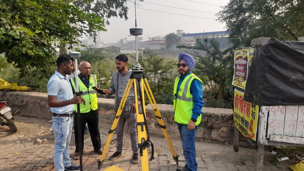
At Destiny Traffic Solutions Pvt Ltd, we offer accurate and detailed Topographic Survey services that are essential for infrastructure planning, road construction, and civil engineering projects. Our team utilizes advanced instruments like Total Stations, GPS, Drones, and LiDAR to capture ground features with precision.

What is a Topographic Survey?

A Topographic Survey is a method of collecting data about the natural and man-made features of a land area. It shows contours, elevations, boundaries, and physical features such as buildings, trees, roads, utilities, and water bodies. This data is crucial for architects, engineers, and planners before starting any development or construction.

Applications:

Road and Highway Design, Railway and Metro Projects, Drainage and Irrigation Planning, Township and Land Development, Environmental Impact Assessment (EIA), Bridge and Tunnel Projects, Urban Planning and Redevelopment

Technology We Use:

Total Station Survey Instruments, Differential GPS (DGPS), Drone/UAV Surveying & Photogrammetry, AutoCAD Civil 3D & GIS Software.

Frequently Asked Questions

  • How do drones improve topographic surveys?

    Drones streamline topographical survey processes by capturing high-resolution aerial images, reducing time and labor costs. Topography drones equipped with GPS, RTK, and photogrammetry software generate highly accurate 2D and 3D terrain models, making surveying faster, safer, and more efficient.